Aerospace
These examples show geospatial capabilities in aerospace applications. Within the examples, use Mapping Toolbox™ software to:
Read and analyze terrain elevation data.
Define areas of interest (AOIs).
Perform field-of-view (FOV) analysis.
Display data on 2-D and 3-D maps.
Featured Examples
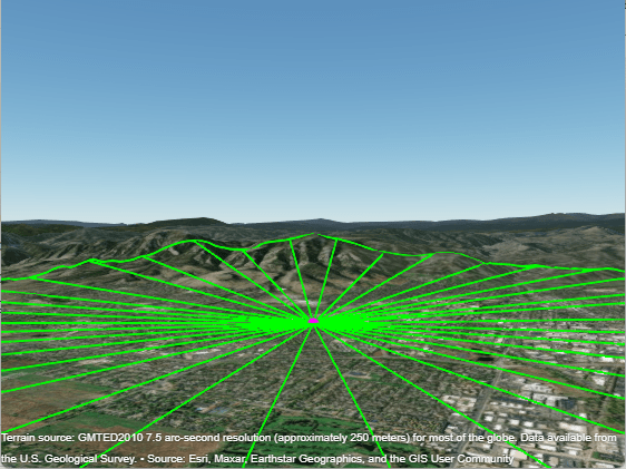
Satellite Visibility Analysis Using Terrain
Analyze satellite visibility from a ground station using a visibility mask computed from the surrounding terrain. A visibility mask is a set of azimuth and elevation angles that define where obstructions block a satellite's line-of-sight visibility.

Lunar Mission Analysis with the Orbit Propagator Block
Compute and visualize access intervals between the Apollo Command and Service module and a rover on the lunar surface. The module's orbit is modeled using Reference Trajectory #2 from the NASA report Variations of the Lunar Orbital Parameters of the Apollo CSM-Module [2]. This is a lunar orbit studied by NASA for the Apollo program. The example uses: