Climate
Geospatial capabilities in climate applications
These examples show geospatial capabilities in climate applications. Within the examples, use Mapping Toolbox™ software to:
Read data from GRIB files.
Define areas of interest (AOIs).
Get geographic coordinates from addresses.
Create 2-D maps.
Featured Examples
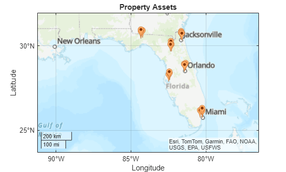
Hurricane Natural Catastrophe Risk Estimation
Model the financial risk for hurricanes in an area of interest by using simulations from a hazard model, data about property assets, and a damage function.
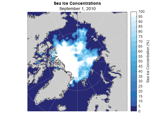
Visualize Sea Ice Concentrations from GRIB Data
Read sea ice concentrations from a GRIB file and visualize the data using a 2-D map, an animated GIF, and histograms.